Atlas
Prüfen Sie jedes Flurstück, bevor Sie entscheiden.
Ein räumlicher Workspace für Analysten und Entwickler. Jedes Flurstück in Deutschland durchsuchen. Die komplette regulatorische und planungsrechtliche Historie lesen. Investitionsreife Belege - quellenbelegt - in einer Ansicht zusammenstellen. Mit den Daten die Sie brauchen erweiterbar.
Geschrieben von Lorenz Wackerle, CEO • Stand: August 2026
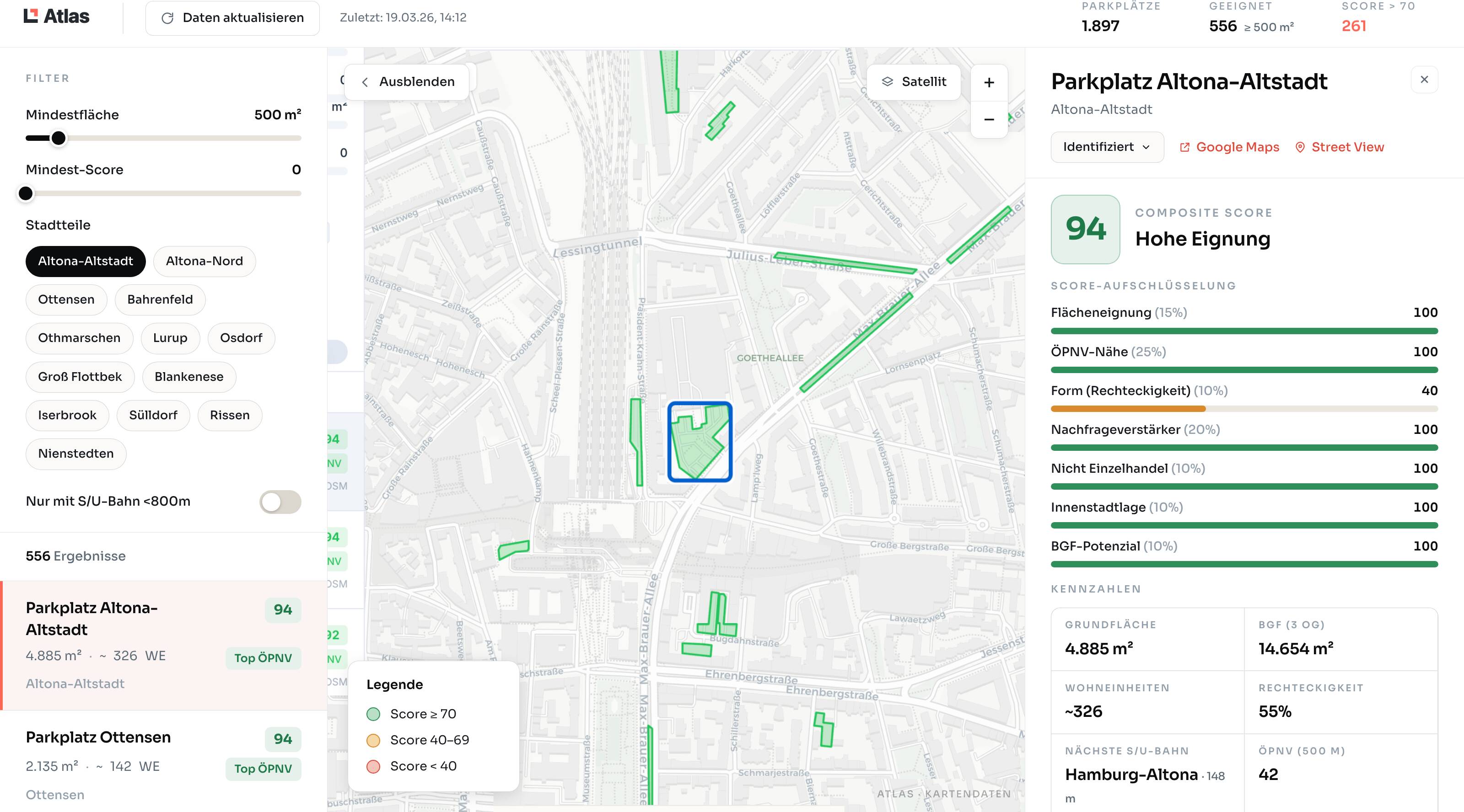
Atlas - Kandidaten-Screening mit Composite Score, Aufschlüsselung und Kennzahlen für das ausgewählte Flurstück.
Abdeckung
11,054
Municipalities in scope
Phased rollout · 16 Bundesländer
60M
Parcels in scope
ALKIS-anchored
10y
Regulatory history target
Backfill in progress
Same-day
Publish-to-index
Sub-hour in pipeline
Was Atlas kann
Gebaut für den tatsächlichen Arbeitstag eines Analysten.
Flurstückssuche
Nach Flurstück, Adresse oder Koordinate.
Geben Sie jede deutsche Flurstücks-ID ein, Postleitzahl + Strasse oder lat/lon. Wir lösen sie über alle 11.054 Kommunen auf - kein Atlas-Hopping.
Regulatorische Zeitleiste
Jedes Signal, auf einem einzigen Band.
B-Pläne, Satzungen, Bauanträge, Anhörungen - alle ans Flurstück gebunden, alle quellenbelegt, zurück bis zur vollen Abdeckungstiefe.
Evidenz-Pakete
Vorstandsfertiges Bündel exportieren.
Ein Klick, um die komplette Akte eines Flurstücks zusammenzustellen - Karte, regulatorische Historie, Quell-PDFs, Eigentumsverfolgung - als zitierbares PDF.
Flurstücks-Vergleich
Zwei Assets nebeneinander stellen.
Sie prüfen die Alternative? Öffnen Sie beide Flurstücke im Split-View und vergleichen Sie regulatorische Exposition, Signalgeschwindigkeit und Nachbarschaftsrisiko.
“Die komplette regulatorische Historie jedes Flurstücks in einer Ansicht - quellenbelegt, zitierbar, exportierbar. Was wir sagen, können wir belegen.”Atlas · Produktprinzip
Bringen Sie uns ein Flurstück. Wir zeigen alles.
Schicken Sie eine Flurstücknummer. Wir öffnen Atlas auf dem Bildschirm und gehen jedes Signal durch, das sie berührt hat - und die Original-PDFs darunter.
Per-Seat-Lizenz · DE/EN · NDA auf Anfrage